Friday, March 31, 2006
Uncharted Territory
Ultraslow ridges hold new clues to crust's formation
Carolyn Gramling
At the top of the world in the late summer of 2001, the U.S. Coast Guard's icebreaker Healy carved a slow path through the ice-covered Arctic Ocean. On board, marine geologist Henry Dick sent dredge after dredge through the ice to the seafloor, searching for telltale rocks that would help shed light on how Earth's crust forms. "People said, 'You'll never get a single rock off the seafloor,'" Dick says. "They said, 'You can't dredge in the ice.'" But in fact, Dick's team collected more than 200 rocks—many of which turned out to be pieces of Earth's mantle.
Under the ice and 2 kilometers of water was a 1,800-km-long underwater mountain range known as the Gakkel Ridge. The Healy's expedition, conducted in tandem with the German icebreaker Polarstern, was the first exploration to that Arctic ridge to attempt to collect geological samples.
The surprising discovery of mantle rocks indicated that Gakkel Ridge is one of only two places known on the planet where the tectonic plates that make up Earth's hard outer crust slide apart and expose large slabs of the mantle on the seafloor. That mantle is normally buried under 6 km of crustal rock.
The other site, the 8,800-km-long Southwest Indian Ridge (SWIR), is on the far side of the world. Like the Gakkel Ridge, the SWIR is utterly remote. It's located beneath treacherous high seas.
Oceanographers are only now beginning to explore these areas in detail. They have already made surprising geological finds, including the exposed mantle. They've also uncovered evidence at both ridges of hydrothermal vents, fissures in the seafloor through which circulating, magma-heated seawater escapes. Researchers say that these two ridges may represent a new class of tectonic boundary, called an ultraslow-spreading ridge. The finding offers scientists the chance to explore new ideas about how Earth's crust forms and to study the rich ecosystems spawned by the vents.
Read more about it at Science News online.
Resolution Pledges to Safeguard Ponds
Voters have an opportunity this spring to pledge support for water quality protection on the Island - and in particular for the recommendations of the Massachusetts Estuaries Project, a landmark study that will provide critical tools for managing the watersheds around the Vineyard's coastal ponds.
"To me the coastal ponds are probably the one most critical environmental feature on Martha's Vineyard and it drives the economy. I think that is why people come here," said Bruce Rosinoff, a coordinator for the estuaries project, from Edgartown.
The project is a six-year collaboration between the state Department of Environmental Protection and the School of Marine Science and Technology at the University of Massachusetts at Dartmouth. It is using hard science and state-of-the-art technology to analyze the health and nutrient carrying capacity of virtually all the estuaries in southeastern Massachusetts.
On the Island, Sengekontacket Pond, Edgartown Great Pond, Tisbury Great Pond, Lagoon Pond and Lake Tashmoo are all enrolled in the study. The first reports are due later this year, and among them will be one addressing the Edgartown Great Pond.
At the special town meeting Tuesday night, Tisbury voters unanimously approved a nonbinding resolution to give careful consideration to the results and recommendations of the estuaries project, and to work with other towns to preserve and restore the quality of the Island's ponds and waterways.
Read the rest here.
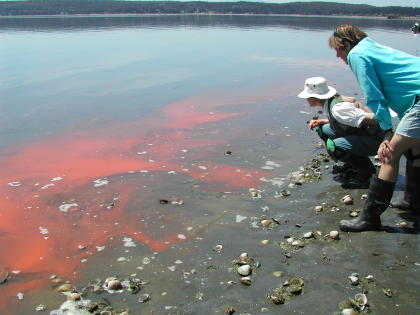
Red tide blooms get more frequent
Gulf summit ends with a discussion of harmful algae
By Brandi Dean Caller-Times
March 31, 2006
When red tide bloomed in Corpus Christi last year, no one knew what caused it, how long it would last or how to get rid of it.
Now an expert on the microscopic algae that kills fish, turns water red and wreaks havoc with respiratory systems has added one more item to the list of unknowns: whether it's coming back.
"We don't have any good way of predicting it from year to year," said Tracy Villareal, a research associate professor at the University of Texas Marine Science Institute.
Villareal, who spoke on harmful algal blooms as a panelist at the State of the Gulf of Mexico Summit on Thursday, said that while he believes science is moving in the direction of understanding red tide, it's slow going. The three-day event sponsored by the Texas A&M University-Corpus Christi's Harte Research Institute for Gulf of Mexico Studies, ended Thursday.
"This is a difficult funding area for oceanography at the moment," he said. "We're talking about a very expensive science. The ocean is very large and we're very small."
One thing he could say, however, is that red tide is increasing in the number of blooms. In the past 15 years, Villareal said more blooms have been reported than in the previous 50. Some of it may be attributable to better reporting, but probably not all of it.
"My suspicion is we're not going to see fewer of them," he said.
But that's not the only thing the Gulf Coast has to be aware of, in terms of harmful algae. There's also Ciguatera, which is the most likely of algal blooms to cause problems for people. Villareal said that between 50,000 and 500,000 people are affected by it every year - the span is large because most doctors wouldn't recognize its many and varied symptoms. There have been reports of the algae in Texas, Villareal said, and it also may be getting worse. The algae lives on reefs, so as humans build more artificial reefs - such as those created by oil rigs - it may spread.
Nancy Rabalais, professor at the Louisiana Universities Marine Consortium, added dead zones to the list of Gulf Coast menaces. Dead zones are areas of oceans with little oxygen. Rabalais said they are because of nutrients - particularly nitrogen - that travel down the Mississippi River and into the Gulf. They eventually become food for bacteria that uses up the oxygen, leaving little for fish and shrimp.
Rabalais said one way of decreasing the dead zone is to decrease the use of nitrogen in fertilizer, but she found one other effective method: hurricanes. The storms stir up the water and redistribute oxygen.
"But that's not really the solution I'm advocating," Rabalais said.
Oceans gradually turning into vast 'fizzy drink'
The cause is the ever-increasing level of CO2 in the atmosphere. And as well as devastating marine ecosystems, the knock-on effects of increasing acidification include harm to major economic activities such as tourism and fishing.
These are the conclusions of the first review of the state-of-knowledge about the acidification of the oceans. The report was produced by an international group of scientists, commissioned by the Royal Society, the UK's national academy of science.
The oceans are naturally alkaline but, since the industrial revolution, the sea surfaces have been turning ever more acidic. The report says that if CO2 emissions continue at current rates then by 2100 the pH of the sea will fall by as much as 0.5 units from its current level of pH 8.2. The pH scale runs from 1 (acidic) to 14 (alkaline), with 7 being neutral. And in the case of the oceans, the change would be effectively irreversible.
"It will take many thousands of years for natural processes to return the oceans to their pre-industrial state," says John Raven, at the University of Dundee, UK.
Chalk dumping
Raven and his colleagues looked at possible ways of neutralising the growing acidity, such as dumping chalk - a highly alkaline substance - into the sea, but all their ideas carried major problems of their own. "The only way to minimise the long-term consequences is to decrease CO2 emissions," Raven says.
The sea life expected to be worst hit include organisms that produce calcium carbonate shells, as these are harder to form in acidic waters. That means that corals, crustaceans, molluscs and certain plankton species will be at risk.
"It would not kill penguins, orca and other big animals directly, but it would affect the food chain with potentially damaging effects on larger animals," Raven explains.
Coral reefs face a three-pronged attack, the report says. There is global warming and coastal pollution, and now acidification. Raven says we can expect to see degradation of coral reefs in the tropics.
Giant blooms
And it does not stop there. There is an important group of photosynthetic plankton called coccolithophores that grow calcium carbonate shells and form giant "blooms" in spring and summer before sinking to the bottom of the ocean.
But the increasing acidification will hinder their ability to grow, meaning they remove less carbon from the atmosphere. This in turn will result in more carbonic acid being formed at the seas' surface.
"Calcium carbonate helps organisms to sink and enhances the biological pump," says Andrew Watson, an environmental biologist at the University of East Anglia, UK. The sea has absorbed about half of the CO2 produced by humans in the last 200 years and currently takes up one tonne of the gas each year for every person on the planet. But if the water becomes too acidic, the pump will not work and the ability of the oceans to mop up CO2 will fall, he says.
"Most climate scientists think the Kyoto targets themselves are wholly inadequate," Watson adds. "We need a sharp decline in CO2 emissions, down to half of today's levels."
SOURCE - New Scientist
Thursday, March 30, 2006
Ireland's First Wave-Energy Generator Arrives in Galway
Galway, Ireland [RenewableEnergyAccess.com] An initiative to open a wave energy test site one and a half miles off the coast of Spiddal, County Galway, is under way with the arrival of the first wave energy generator, Wavebob, which has arrived at Galway Docks. Made possible by the Marine Institute and Sustainable Energy Ireland, the 37-hectare Galway Bay test site will be open for engineers to field-test other prototype ocean-energy generators as well, all in the interest of harnessing the power of the Atlantic Ocean.
"The most energetic waves in the world are located off the West coast of Ireland," said Peter Heffernan, Marine Institute, CEO. "The technology to harness the power of the ocean is only just emerging and Ireland has the chance to become a market leader in this sector."
Wavebob will test a quarter-scale prototype, which is hoped to provide the most accurate evidence to date for the cost and performance potential for the device. Wavebob has already gone through a rigorous path of theoretical modeling followed by small-scale prototype testing in wave tanks. Some of this testing has been performed at the Hydraulics and Maritime Research Center, University College Cork.
Both agencies have been working closely to develop a research and development strategy for ocean energy technology in Ireland. This strategy will define a phased approach toward product development complemented by an outline of the investment levels required to sustain the development of an ocean energy industry in Ireland. The Marine Institute and Sustainable Energy Ireland (SEI) have invested Euro 300,000 [USD$365,000] in university-based research and a further Euro 850,000 [>USD$1 million] in industry-based research of ocean energy technology.
It is expected that the implementation of the Ocean Energy Development Strategy will see a progressive increase in the range and scale of research and innovation investment. In 2004, Teresa Pontes of Portugal, an ocean energy expert who spoke at an EurOcean marine science event in Galway, said that up to 20 million homes in Europe could be powered by clean, renewable energy from the sea. She estimated that by harnessing energy from waves and ocean currents, Europe could produce around 200 terawatt (200 million megawatt) hours per year of electrical power.
The Marine Institute, which hosted the event during Ireland's EU presidency, is mandated to spearhead all aspects of marine R&D leading to the sustainable development of Ireland's 220 million acres of underwater territory and has also drafted a comprehensive marine research and development strategy for the next seven years.
Lake Victoria's Water Level Dropping
Though pastoral when British explorer John Hanning Speke became the first European to explore its shores, today, Lake Victoria in East Africa is one of the most populous regions in the world. The lake provides food, transport, and electricity to more than 30 million people, but its resources are limited. Despite its impressive size—it’s the third-largest lake in the world—Lake Victoria is shallow, resembling, in Speke’s words, “the temporary deposit of a vast flood overspreading a large flat surface.” Until the Owens Falls Dam began to regulate water levels from the lake’s only outlet in 1954, the amount of water in the lake jumped drastically from year to year depending on rainfall. Though water levels continued to vary after the dam was built, they remained more than 11.9 meters above a gauge in Jinja, Uganda. But in early 2006, the Jason-1 satellite revealed that Lake Victoria had reached lows not seen since well before the dam was built.
Read more here.
This is major. Humans haave already fucked up Lake Victoria by introducing a food and game fish, the Nile Perch, to the lake which has decimated the native fish populations, increased runoff and nutrients are also creating hazards for these cichlids which use visual cues to spawn, among many other problems facing the lake. This is a sad sad time for the African Rift Lakes...
GLENDA!!!!
Tropical Cyclone Glenda formed off the northwestern coast of Australia on March 27, 2006. The storm quickly built into a powerful and well-defined cyclone during the next day. Powerful winds have whipped up surf along the coastline of Western Australia’s Pilbara region and brought powerful winds and rain to the islands off the Kimberly coast. As of March 29, 2006, the storm had reached Category 5 status, the maximum rating possible for a cyclone.
This photo-like image was acquired by the Moderate Resolution Imaging Spectrometer (MODIS) on the Terra satellite on March 29, 2006, at 10:40 a.m. local time (02:40 UTC). It shows Cyclone Glenda as a well-developed storm, sitting 525 kilometers (330 miles) west of Broome. Clouds from the storm covered most of the northwest coastline of Western Australia. Sustained, peak winds in the storm system were roughly 220 kilometers per hour (140 miles per hour) at this time. The storm’s spiraling clouds appear as a nearly solid white disk, but in several places, it appears as though some clouds are “boiling” up above the rest.
Predictions as of 2:55 a.m. Australian Western Standard Time on March 30 were that the storm would cross the coast between Exmouth and Karatha on Thursday afternoon or night as a very dangerous storm. The Australian Bureau of Meteorology predicted that wind speeds near the storm center could reach 265 kilometers per hour (165 miles per hour) as the storm comes ashore. Many coastal communities were being evacuated by State Emergency Services ahead of the storm.
That is the second massive cyclone of the season to hit Australia... anyone still think global warming has nothing to do with it???
Massive sewage spill closes Oahu beaches
HONOLULU, Hawaii (29 Mar 2006) -- Warning signs to keep out of the water were posted Wednesday along part of Waikiki's world-famous beaches because of high bacteria levels from a massive sewage spill.
Ocean currents shifted toward Oahu's south shore beaches, carrying millions of gallons of raw sewage that was diverted into a canal from a broken pipe and into the ocean.
"What we feared has happened. The bacteria has kind of spread through areas of Waikiki," state Health Department spokesman Kurt Tsue said.
Environmentalists and residents fear long-term damage to the fragile coral reef and other marine life in the area.
"This is absolutely disgusting that here at the doorstep of our economic engine we have untreated sewage on the beaches. This should have never happened," said Jeff Mikulina, director of the Sierra Club, which filed a lawsuit in 2004 alleging deficiencies in the city's wastewater system.
The normally packed beaches remained open but were mostly empty. Rainy weather kept many tourists away, and those on the beach were greeted by signs that warned against swimming or fishing, saying, "Sewage contaminated water. Exposure to water may cause illness."
The city was monitoring the water in a several-mile stretch from Diamond Head to near downtown Honolulu. Bacteria levels near the beaches were not at threatening levels, but enough to put out a warning, Tsue said.
The city was trying to determine how much untreated sewage has been diverted into the canal, which empties into the ocean between two of Hawaii's most famous beach areas _ Waikiki and Ala Moana.
It could exceed 50 million gallons, considering an average 15 million gallons of wastewater a day flows out of Waikiki.
The city has been using pumps around the clock since the sewer line broke early Friday. Repairs on the 42-inch sewer main were completed Wednesday and the diversion into the canal was finally stopped.
The pipe, installed in 1964, cracked after heavy rain flooded the aging sewer system.
Tuesday, March 28, 2006
Feeling the Heat: The World Wakes Up
Two thousand and six is emerging as the year Americans finally wake up to the reality of global warming. Of course, E has been hammering away at the issue for six years or more, but now it has momentum, with the release of several new books and a Time magazine cover story ("Be Worried, Be Very Worried") April 3.
An ABC/Time/Stanford University poll accompanying the article confirmed that Americans are finally focusing on the problem. Today, 85 percent of Americans believe that global warming is occurring, versus 13 percent who don't. Sixty percent of respondents admit to worry about it either "a great deal" or "a good amount." Sixty-eight percent think the federal government should do more to combat it. (It's doing virtually nothing now.)
HERE ARE SOME OF THE EXMAPLES LISTED IN THE ARTICLE, WHICH YOU SHOULD READ HERE:
The California Coast: Migrating Species
New York: The Virus Specter
Florida: Dying Coral
Pacific Northwest: The Incredible Shrinking Glaciers
Antigua: Stronger Storms
ALL I CAN SAY IT'S ABOUT TIME THE AMERICAN PUBLIC START BECOMING MORE INFORMED AND WISE TO THE FACT THAT GLOBAL WARMING IS OCCURRING
Pacific isles get wildlife drive
A major initiative has been launched to conserve the fragile wildlife of the islands of the Pacific.
It includes a commitment to protect nearly a third of coastal waters and a fifth of the land area of Micronesia.
The announcement was made on the fringes of a UN conference on the protection of the world's biodiversity.
Scientists have warned that the variety of life on Earth is declining at a rate unprecedented since the demise of the dinosaurs.
In a separate move, one of the world's largest marine parks will be created in the Pacific island nation of Kiribati to protect an extraordinary untouched coral ecosystem.
Island extinctions
Islands contain a disproportionate number of the world's species, as their isolation over millions of years has resulted in separate evolutionary pathways.
For example, the exotic white-crested Kagu (Rhynochetos jubatus) is the sole member of an entire bird family, and lives only on the island of New Caledonia.
Arc-eye hawkfish
The islands are home to 500 species of fish
Some 16% of the world's known plant species have evolved on islands and their coastal waters contain half of the planet's variety of marine life.
This isolation makes the wildlife uniquely vulnerable to extinction as environmental changes in just a small area can easily wipe out entire species.
Half of all known extinctions have involved island species, including the notorious case of the dodo on Mauritius.
Current threats include deforestation, over-fishing and the degradation of coral reefs, 30% of which are already severely damaged.
Future of fishing
The initiative to increase protection of Pacific islands was launched by the president of the tiny nation of Palau, an island group with a human population of barely 20,000.
Turtles mating, Phoenix Islands Protected Area
The reserve will allow marine wildlife to develop in peace
Its aim is to provide effective protection by 2020 of 30% of the inshore marine life of the ocean region of Micronesia, and of 20% of land ecosystems.
At the launch of the programme in the Brazilian city of Curitiba, a total of $18m was pledged towards conservation in Micronesia, coming from a combination of government funds, conservation organisations and international finance institutions.
The new marine protected area in Kiribati will cover an area twice the size of Portugal, and will heavily restrict human activities in the Phoenix Islands, a group of eight coral atolls between Hawaii and Fiji.
They are nearly uninhabited, and have stunned conservation scientists with an extraordinary variety of unique wildlife including 120 species of coral and more than 500 fish, some new to science.
In addition, it is an important stopping point for migrating birds and sea turtles.
While the Phoenix Islands are still in a remarkably pristine condition, the creation of the new protected area is designed to prevent future damage from over-fishing and to offset the impact of climate change.
This will involve setting up an endowment fund to compensate the government of Kiribati for revenue it could have got from the issuing of commercial fishing licences, and also to finance professional management of the wildlife.
It is hoped that by protecting coral ecosystems, the long-term future for small-scale fishing can be secured for people in the region, as the reefs provide important spawning grounds.
'Major milestone'
The island initiative is being contrasted with the slow pace of global efforts to address the crisis of biodiversity loss, with the government negotiations at this UN convention getting bogged down in arguments over finance and the rules for sharing profits from products such as drugs obtained through traditional knowledge of plants.
There has been concern from conservation organisations that while a growing proportion of land-based ecosystems are at least officially protected, the process of designating ocean areas for conservation has barely begun.
Russ Mittermeier, of the group Conservation International, which is helping to sponsor the Phoenix Islands protection scheme, said: "This is a major milestone for marine conservation efforts in the Pacific and for island biodiversity."
"The Republic of Kiribati has shown unprecedented vision for long-term conservation of its precious marine biodiversity."
Fish protection areas questioned
Research from Newcastle University for the British Government's Department for Environment, Food and Rural Affairs (DEFRA) indicates that such proposals by environmentalists are misguided.
Marine protected areas (MPAs) would need to be tens of thousands of square miles in size – at least as big as the size of Wales – and be established for decades to restore levels of cod and haddock, says the report.
Moreover, creating large MPAs would be likely to intensify fishing in the waters left open for business, so further measures to reduce activity would have to be brought in.
However, the report's authors suggest that these 'drastic' measures are unlikely to be feasible and would require a significant policy shift for them to be implemented.
They also acknowledge that there is an 'information deficit' regarding the costs and benefits of MPAs, particularly in the case of the North Sea, and call for more research.
Environmentalists and public bodies such as the Royal Commission on Environmental Pollution are lobbying the British Government to introduce MPAs in parts of the North Sea to conserve marine life and restore fish stocks.
A team of marine ecologists from the University of Newcastle upon Tyne were asked by DEFRA to assess likely effects of MPAs in UK waters.
The report highlights that many MPA advocates are basing their opinions on scientific evidence garnered from small, conservation-oriented MPAs largely in tropical waters.
Although the Newcastle team acknowledges that MPAs have brought many benefits to the tropics and elsewhere, it stresses this experience can not be applied to the North Sea, which possesses very different habitats and species.
According to the report, small MPAs have conservation and localised fishery benefits in the UK, which is good news for shellfish and finfish (e.g. scallops and lobsters).
The MPAs will have to be very large to achieve recovery of North Sea cod stocks, though.
"Evidence suggests closing off small areas of the ocean won't deliver results with regard to highly mobile species like cod and haddock," said Professor Nicholas Polunin of Newcastle University's School of Marine Science and Technology.
"You need to create bigger protected areas and enforce them for several decades if you are to see a significant, lasting effect on stocks, which are massively depleted to historically low levels.
"However, this would raise the problem of intensive fishing activity in areas that are left open and further fishing restrictions would have to be brought in to address this."
This article brings up valid points. Much of the MPAs in place today are located in tropical waters, especially around reefs and the like. These fish are often not highly migratory, and therefore, MPAs work. But for larger, coldwater migratory species, small no take zones may or may not help. I am not suggesting they shouldn't try, because something needs to be done. Cod is afterall the fish that changed the world, and needs to be saved. Speaking of which, youu should read the book called "Cod: A Biography of the Fish That Changed the World" by Kurlansky, good read.
Shallow Water Seagrass Beds Are Vanishing
DURHAM, New Hampshire, March 28, 2006 (ENS) - Around the world, seagrass beds are in decline, says a scientist who has been studying the shallow water ecosystems for decades. As these underwater meadows disappear, so do commercially valuable shellfish and fish, waterfowl and other wildlife, water quality, and erosion prevention.
Frederick Short, research professor of natural resources and marine science at the University of New Hampshire, compares seagrass beds to forests on the ocean floor.
From the Hudson Bay, where the Cree Nation enlisted him to transplant their diminishing eelgrass beds, to the Pacific Island of Palau, Short has found the same thing.
"Almost everywhere we start monitoring seagrass, it’s declining," he says. While conclusive global results are not yet available, Short believes human impact is responsible for the decline.
Short, who founded the global monitoring program SeagrassNet in 2001, has been studying eelgrass, a type of seagrass found in the Northern Atlantic, for more than 20 years.
While he still conducts research at the University of New Hampshire’s Jackson Estuarine Laboratory on the Great Bay Estuary in Durham, he also collaborates with teams of researchers to monitor seagrass health at 45 sites in 17 countries worldwide.
Among the most productive plant communities on the planet, seagrass beds serve as protective nurseries for juvenile fish and shellfish, a habitat for many marine species, and a feeding ground for predatory fish, waterfowl and large sea creatures like manatees and sea turtles.
The root and rhizome system of these flowering plants stabilizes sediments, protecting the coastline from currents and weather-related erosion. Seagrass is an effective filter of nutrients and particulates, and it is the basis of a detrital food chain that feeds fish and shellfish.
At a state park in Malaysia, SeagrassNet has charted a decline since 2001 at both a "pristine" site and a less protected site.
Satellite imaging showed researchers that the impact was not due to a global force like climate change, but rather to on-shore logging that had increased the level of water-borne sediments at both sites, decreasing light reaching the bottom, where seagrasses grow.
Short and his SeagrassNet colleagues have not ruled out global climate change as a factor in the decline of seagrass beds. But the reasons for seagrass declines appear to be more localized. "Human pollution of the water has been the biggest issue," he says.
In remote areas of the Hudson and James Bays in sub-Arctic Canada, where members of the Cree Nation noticed their seagrass beds diminishing, Short observed that the beds were in the plume of fresh water released from a nearby Hydro-Quebec power plant. The fresh water influx decreased the salinity so much that the seagrass could no longer survive.
When seagrass beds disappear, Short says, the impact is major. A disease outbreak in the 1930s wiped out 90 percent of eelgrass in the North Atlantic. The scallop fishery in the mid-Atlantic disappeared, says Short, and "it’s never really come back."
In Thailand, where SeagrassNet researchers have begun investigating the impact of the December 2004 tsunami on seagrass, the beds provide local fishers with significant shellfish. "If the seagrass beds disappear, so do the people’s protein sources," says Short.
His work in Thailand highlights the reason for the worldwide monitoring program. Prior to SeagrassNet, little was known about seagrass in many locations around the world. With no baseline, assessing the impact of a disturbance like the tsunami is difficult.
Short is adding new sites to SeagrassNet around the world and, in New England, researching effective ways of restoring eelgrass to areas where water quality has improved.
A site selection model he has developed helps researchers determine areas that are optimal for restoring diminished eelgrass beds with sod-like patches.
As SeagrassNet researchers input their data into an online database, Short is now working on data analysis from the first five years of SeagrassNet monitoring.
At the same time, he will continue to add new sites to the global monitoring network. "It’s growing just as fast as I can grow it," he says.
For more information visit: http://www.seagrassnet.org
THIS IS of particular importance to me because I have been working with seagrasses for the last 3 years. I am also going back to school and will be working with eelgrass in Long Island. This is a very important species in so much as many, many commercially and recreationally important fin and shellfish species rely on seagrasses as a refuge or for food during some part of their life cycle. We need to protect these vital ecosystems...
Monday, March 27, 2006
Fisheries being plundered, researchers say
By Juliet Eilperin, The Washington Post | March 27, 2006
Highly mobile fishing fleets are exploiting the sea's resources at an unsustainable rate, according to a new paper published Friday by more than a dozen international researchers in the journal Science.
The paper, which looks at how ''roving bandits" swoop in and plunder fisheries at a rapid rate, examines how some fish populations have collapsed within a matter of years. In Maine, the sea urchin became a popular commodity in Japanese sushi markets in the mid-1980s: After peaking in 1993, the catches declined precipitously.
The paper, authored by 15 Canadian, Australian, US, Swedish, and Dutch ecologists, social scientists, and resource economists, concludes that even marine protected areas such as the Great Barrier Reef Marine Park, the largest marine protected area in the world, ''is too small to fully maintain stocks of marine mammals, turtles and sharks that migrate across its boundaries."
Dalhousie University professor Boris Worm, one of the co-authors, said ''existing marine protected areas are too small, too few and too far apart to prevent the tragedy of the oceans, which is arising due to the unbridled demand for seafood."
The study cited new export demands from the restaurant and aquarium trades, more sophisticated fishing technology, and rapid air transport of fish.
USF Oceanographer Sees "Oceans of Trouble"
Newswise — Over the past three years, two distinguished panels - the U.S. Commission on Ocean Policy and the Pew Oceans Commission - released major reports that found our oceans and coasts in serious trouble. Like the 9/11 Commission, the Ocean Commissions proposed detailed recommendations to avert a crisis in homeland security. The homeland crisis in our oceans, however, is getting worse, not better, says a Florida oceanographer.
“So far, those who could make a big difference have ignored most of the recommendations,” said Frank Muller-Karger, a professor at the University of South Florida College of Marine Science who served on the 16-member U.S. Commission on Ocean Policy. “Inaction continues to impact our health, economy and jobs. We continue to be short-sighted and manage our ocean resources by crisis rather than by conscience.”
According to Muller-Karger, the nation's marine territory is at risk, suffering from increasing pollution, over fishing and problems related to over-development.
“Federal waters are like federal lands - whatever is in them belongs to all of us, not to the government, or some company,” charges Muller-Karger. “Our goal should be to hold our government accountable for managing our resources properly, and doing it in a way that does not deplete them in the lifetime of our generation. To me, this means that we need an ecosystem-based management strategy.”
Muller-Karger advocates for the need to recognize that water, air and living and non-living resources do not follow - or live by - political boundaries.
”The oceans are an interconnected web of animals, plants, and people living across a complex geography,” he explains. “A change in one area sends a ripple that affects everything else in the system.”
Members of both commissions created the Joint Ocean Commission Initiative, which released an Ocean Policy Report Card evaluating efforts made by the administration and Congress.
“The results are discouraging,” he says. "The average grade was a barely passing D+.”
One serious problem, says Muller-Karger, is that we have upwards of 14 federal agencies charged with ocean issues. These agencies are, in turn, overseen by more than 60 congressional committees and subcommittees.
“There is too much duplication, too little coordination and too little funding," he charges.
Moving in the right direction doesn’t have to be very expensive. The U.S. Commission on Ocean Policy carefully estimated the costs of each of its recommendations. They concluded that an Ocean Policy Trust Fund of between two and four billion dollars per year should be established to better support management of our oceans and coasts.
“No one, as of yet, is talking about such a trust fund, which leads to an “F” on the report card for lack of funding,” asserts Muller-Karger. “This is a modest investment compared to the ultimate benefit of protecting our property, life, and coastal resources. It is an investment that will stimulate our coastal economies.”
Muller-Karger also suggests that all is not lost. Through public awareness and public activity, through events such as the upcoming “Oceans Day,” which Floridians will celebrate April 19, information about the importance of our ocean resources can be communicated to policy makers.
Historically, Oceans Day has been a day for impressing lawmakers with the importance of preserving the natural integrity of the oceans and taking positive steps to repair what has imperiled them, especially the harm done by neglect and abuse at the hands of humankind. Eagerly supported by students, staff and faculty at the University of South Florida’s College of Marine Science, the Florida Ocean Alliance’s (http://www.floridaoceanalliance.org) celebration of Oceans Day 2006 in Tallahassee promises to highlight the plight of our oceans as well as celebrate their beauty and emphasize their importance as an irreplaceable resource.
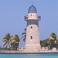
Boca Chita Key
So today, we needed to test our Mako engine to make sure it was running fine before our six week sampling period. So we launched out of Biscayne National Park range station and shot across the bay to Elliot Key, but we decided to check out Boca Chita Key instead. Its a small key that has natural inlets running along both north and south sides and the ocean on its east side (of course). Anyways, its a cool little place, where you can dock your boat and camp out overnight if you want. Like I already said, it is small, and you can see the whole thing in less than an hour. But if you have the time, you can go snorkeling around the island, there's lots of grass beds, its not too deep, and reef formations on the ocean side (although I haven't snorkeled out on the ocean side). We saw some pretty cool stuff today, including a big scrawled cowfish in inches of water, so content in its feeding it didn't seem to notice that its back was out of the water.
On the ocean side of the island there are lots of tidal pools (the island is like an old coral reef head that become exposed in lowering sea levels)which did not have too much life other than sergeant majors and sea urchins, although in one pool there was a baby tang, even though it didn't stick around long enough to get a good look at it. It was fun looking around there none-the-less and you should definitely check it out sometime.
Fujicco Discovers that Hot-water Extract of Kelp Helps Suppress Blood Sugar Rise
Tokyo, Mar 27, 2006 (JCN) - Fujicco, one of Japan's leading processed food manufacturers, announced on March 23 that it has discovered a unique property of a hot-water extract of kelp in collaboration with the Tokyo University of Marine Science and Technology.
Specifically, the two partners have found that the hot-water extract of kelp substantially suppresses the rise of blood glucose levels in glucose-tolerance tests using mice.
Further, they have elucidated that the extract inhibits the absorption of sugar from the intestines. Fujicco expects that these findings will lead to the development of novel health foods.
Details of this achievement will be presented at the Annual Meeting of the Japanese Society of Fisheries Science to be held in Kochi from March 29 to April 2.
Sunday, March 26, 2006
VIMS: Pfiesteria bloom never happened
Anybody remember Pfiesteria hysteria? It was a raging crisis in the Chesapeake in 1997, when schools of menhaden pocked with sores went belly up in the Pocomoke River. The toxic dinoflagellate Pfiesteria piscicida was suspected of killing them, and of making people sick, too. Scientists and health officials swarmed in, concerned the affliction would spread. Nine years and millions of dollars later, here's what researchers at the Virginia Institute of Marine Science have to say about Pfiesteria:
Never happened. "My best scientific consideration is that Pfiesteria is not an issue in the Chesapeake and never was," says Wolfgang Vogelbein of VIMS. After extensive research, he suspects a fungus-like organism was to blame.
"The researchers were never able to isolate the [Pfiesteria] toxin," says Harley Speir of Maryland's Department of Natural Resources. "We do know those ugly sores were from a fungus, not Pfiesteria."
We bring up old news because a new affliction with a weird name looms in the nation's largest estuary. It's mycobacteriosis, a sickness caused by bacteria from the same germ family that produces tuberculosis and leprosy in humans. VIMS says up to 70 percent of rockfish (striped bass) in the bay are infected, and though there's no way to estimate subsequent mortality in the wild, myco is considered 100 percent fatal when it strikes rockfish in aquaculture ponds.
It's a slow "wasting disease" like TB that leaves stricken fish skinny and weak. It affects internal organs first. By the end, rockfish are emaciated and covered in red sores. A strain of myco also causes "fish handler's disease," a nasty hand infection resulting from exposure through cuts or nicks. In severe cases it gets deep into joints, forcing doctors to amputate digits or even limbs.
Mycobacteria is clearly no joking matter. Resource managers have been aware of its presence in bay rockfish for nearly a decade and believe it may be getting more prevalent. Some believe overall natural mortality for rockfish is increasing and myco may be a cause. Many think declining water quality and declining food sources in the bay stress fish to the point they are more susceptible to these naturally occurring bacteria.
On the other hand, coastal stocks of stripers are at a record high and some think the crisis is overblown. There are opinions of every stripe but little solid information. Worried officials reassure anglers and seafood-eaters that rock, the bay's premier sport and table fish, is safe to eat. But they also caution diners to stay away from raw rockfish and tell anglers to handle fish carefully, particularly if they show lesions, as a small percentage of rockfish do.
A front-page story on myco in The Post two weeks ago sent rockfish market prices plunging by half. It came at a rough time for the sportfishing industry. Charter skippers worry that apprehensive anglers now won't book spring trips. Rockfish season opens April 15 in Maryland and in the lower Potomac, May 1 in the District and May 15 in Virginia's portions of the bay.
It seems like a decade doesn't go by without a crisis on the bay. In the 1970s it was Kepone, a poison dumped into the James River that afflicted fish; in the '80s it was acid rain, thought to be ruining rockfish spawning success; in the '90s it was Pfiesteria. Now comes myco.
"When I saw that headline ["Chesapeake's Rockfish Overrun by Disease," Post, March 11], I thought 'Here we go again,' " said Mike Slattery, assistant secretary of Maryland's DNR.
But officials are far from unconcerned. Almost a decade after myco was first detected in rockfish, there are many more questions than answers. Vogelbein, who is seeking federal grants to ramp up research at VIMS, lists these unanswerables atop the list:
What is the extent of rockfish mortality? Does the disease go dormant? Can rockfish get over it? Does it affect spawning success? Can it spread to other species?
READ THE REEST OF THE ARTICLE HERE.
Saturday, March 25, 2006
save something
Here, check out Care2... It's a cool site where all you need to do is click to savee land, animals... Plus you can sign up to get all sorts of environmental alerts and the likes as well as sign petitions if you so choose... DON'T LET CANADIANS KILL FUR SEALS!!!
boycott the exxon!
Dear friends,
I just sent an email to ExxonMobil to let them know that I will not buy ExxonMobil gasoline unless -- and until -- ExxonMobil takes meaningful action to curb global warming, to invest in renewable energy, and to pay for the damages done by the Exxon Valdez oil spill in Alaska.
It's time to hold ExxonMobil responsible for putting corporate profits over protection of wildlife and wildlife habitat. Please join me in boycotting ExxonMobil! http://go.care2.com/66837
Thank you!
Thursday, March 23, 2006
Deep-Sea Fish Populations Boom Over the Last 15 Years
The largest habitats on Earth are located in the vast, dark plains at the bottom of the ocean. Yet because of their remoteness, many aspects of this mostly unexplored world remain mysterious.
New research led by Scripps Institution of Oceanography at the University of California, San Diego, has produced a rare insight into animal populations in the deep sea.
In first-of-its-kind research published in the March issue of the journal Ecology, David Bailey, Henry Ruhl and Ken Smith of Scripps analyzed fish and other marine animals over a 15-year period in the deep sea of the eastern North Pacific Ocean. At the site, the source of one of the longest time-series studies of any abyssal area in the world, the scientists found a threefold increase in fish abundance, an upsurge that appears to have been driven by an increase in the food available to the animals.
Bailey says the study is a unique glimpse into fish populations undisturbed by human influence.
“This is a rare study of a large marine fish population that doesn’t get commercially fished,” said Bailey. “Other fish populations have their abundances, body sizes and life histories altered by fisheries activities, so our study probably gives us some information about how fish communities work when they are not driven by human exploitation.”
The Ecology study follows research published in 2004 by Ruhl and Smith that showed that significant changes in the deep-sea environment were likely driven by changes at the surface of the ocean by El Niño and La Niña events
.
Such oceanographic events, along with longer-term shifting called the Pacific Decadal Oscillation, can bring more nutrients to surface waters. While animals near the surface can rapidly benefit, it can be months to years later for changes to extend to the ocean bottom, leading to a proliferation of bottom-dwelling invertebrate animals that make up some part of the food supply of deep-sea fishes.
This appears to have been the case from 1989 to 2004, when the researchers found a nearly three-fold increase in deep-sea fish called grenadiers, animals related to cod that are also known as “rattails.” Species included Coryphaenoides armatus, or abyssal grenadier, an animal found worldwide at depths of 2,000 meters and greater, and Coryphaenoides yaquinae, a fish of which little is known and that is found only in the deep North Pacific.
Grenadiers eat a range of foods, from the dead bodies of fish and whales to invertebrates such as worms and crustaceans. The most commonly observed animals on the seafloor include sea cucumbers, sea urchins and brittle stars, and these appeared to form part of the grenadiers’ diet. The researchers used the abundances of these animals as an indicator of food supply to the fish. Large changes in the abundances of these animals were followed by changes in the numbers of fish, with both groups increasing in number over the 15-year study.
The researchers say their results indicate that animals in the deep sea live in an environment in which food supply drives population levels, called a “bottom-up control,” rather than a “top-down control” situation in which predator pressure controls prey abundances.
“The predominant trend had been that people thought that fish have a powerful effect on their environment, and they drive the changes in everything else,” said Bailey, a postdoctoral researcher at Scripps and lead author of the study. “What we’ve seen is the reverse, that fish are responding to a change in their habitat. We think that a lot of fish communities are fundamentally changed by fishing. Our study is really nice in that we are working on populations that have never been fished, so their population dynamics can be seen being driven by natural processes.”
Comparing these observations to those for shallow water, the researchers speculate that deep-ocean and shallow-water fish communities' work differently. A possible reason is that the deep ocean is dependent for its food on material falling from the communities nearer the sea surface; this food supply is smaller and less predictable than that available to most shallow-water fish. The effects of this difference on the dynamics of fish communities are not known, and are being explored using mathematical models as the investigators move forward with this project.
Information for the research paper was derived from “Station M,” a study site 136 miles west of the California coast that has been explored by members of Smith’s laboratory since 1989. The researchers obtained images of the animals through a camera mounted on a sled towed across the ocean floor at more than 13,000 feet deep.
The research was supported by the National Science Foundation, the University of California, Scripps Institution of Oceanography and a Marie Curie Outgoing International Fellowship (European Union).
Arctic, Antarctic Melting May Raise Sea Levels Faster Than Expected
BOULDER, Colo., March 23 (AScribe Newswire) -- Ice sheets across both the Arctic and Antarctic could melt more quickly than expected this century, according to two studies that blend computer modeling with paleoclimate records. The studies, led by scientists at the National Center for Atmospheric Research (NCAR) and the University of Arizona, show that Arctic summers by 2100 may be as warm as they were nearly 130,000 years ago, when sea levels eventually rose up to 20 feet (6 meters) higher than today.
Bette Otto-Bliesner (NCAR) and Jonathan Overpeck (University of Arizona) report on their new work in two papers appearing in the March 24 issue of Science. The research was funded by the National Science Foundation, NCAR's primary sponsor. The study also involved researchers from the universities of Calgary and Colorado, the U.S. Geological Survey, and The Pennsylvania State University.
Otto-Bliesner and Overpeck base their findings on data from ancient coral reefs, ice cores, and other natural climate records, as well as output from the NCAR-based Community Climate System Model (CCSM), a powerful tool for simulating past, present, and future climates.
"Although the focus of our work is polar, the implications are global," says Otto-Bliesner. "These ice sheets have melted before and sea levels rose. The warmth needed isn't that much above present conditions."
The two studies show that greenhouse gas increases over the next century could warm the Arctic by 5-8 degrees Fahrenheit (3-5 degrees Celsius) in summertime. This is roughly as warm as it was 130,000 years ago, between the most recent ice age and the previous one. The warm Arctic summers during the last interglacial period were caused by changes in Earth's tilt and orbit. The CCSM accurately captured that warming, which is mirrored in data from paleoclimate records.
Read the rest of the article here.
DOMESTIC SURVEILLANCE?
Well not really, but this is pretty cool:
"Big Brother" Peers Into Black Drum Bedrooms
A team of scientists from the University of South Florida College of Marine Science (CMS) recently deployed unique instrumentation to locate sound producing black drum fish that raise a loud chorus when they spawn and then determine if the sound production was matched by real results - tight clusters of newly fertilized fish eggs.
"Sound production by black drum serves as proxy for spawning," said marine biologist Jim Locascio. "We want to see if it is possible to find out how much sound production from the black drum equals how much egg production."
Locascio teamed with chemist and environmental scientist Eric Steimle (http://usfnews.usf.edu/page.cfm?link=article&aid=504), who developed a radio-controlled guided surface vehicle (GSV). For the deployment, Steimle's GSV carried a DIDSON imagining sonar and a hydrophone listening device to eavesdrop on the spawning sounds of black drum.
To compliment data collected by the DIDSON, USF Center for Ocean Technology engineer Bill Flanery contributed SIPPER, an imaging sensor mounted underneath the GSV. SIPPER was installed to digitally image and count small particles in the water - from seaweed to plankton - as the GSV -criss-crossed the football field-sized canal area. They hoped that SIPPER would discover clusters of newly fertilized fish eggs in the singing locations.
"The DIDSON creates images from sound and provides near video-like quality," explained Locascio. "We used DIDSON as a high resolution fish finder to image the spawning fish and then have SIPPER image and count the eggs being produced."
Their previous research used only hydrophones to locate the sound producing fishes, but this research attempted to image the adults and newly spawned eggs, giving a comprehensive look into the activity and production of the spawning population.
To test the unique system, the team traveled in mid-March to black drum spawning grounds in the canal system of Cape Coral, Florida, near Charlotte Harbor. The canal system is in the back yards of residential areas where Locascio and colleagues in 2005 were called in by residents to help explain odd noises from the canal, sounds so loud and spooky that residents were left unnerved. CMS researchers subsequently identified the sound as black drum males crooning love songs during spawning. The canal system is not far from an area near where CMS researchers recorded fish raising a chorus when Hurricane Charley rolled over the same waters in 2004 (http://usfnews.usf.edu/page.cfm?link=article&aid=685).
"All systems operated well and weÂre analyzing the data," reported Locascio after the test.
Locascio and plankton biologist Andrew Remsen, who are analyzing the images collected by SIPPER, want to determine if the sounds picked up by the hydrophones are concurrent with the number of eggs seen in the SIPPER images. To do so, they are looking at tens of thousands of digital pictures that are cross-referenced to exact locations in the area that SIPPER and DIDSON, riding under the GSV, surveyed together in real-time.
SIPPER can image and identify objects down to 1/4 of a millimeter and image subjects as small as a human hair while viewing 15 liters of water every second.
According to Flanery, an early concern was that riding just beneath the surface SIPPER would be imaging a lot of bubbles and that it might not be able to easily tell the difference between bubbles and fish eggs.
"We were pleasantly surprised to find that the images were easily distinguishable because SIPPER's recognition software was able to sort the images," said Flanery.
This was the first field assignment for SIPPER and DIDSON to jointly ride as GSV passengers and explore the relationship between male fish spawning sounds and the discovery of newly fertilized eggs. It was also the first deployment of the third version of SIPPER, SIPPER3.
"Eric's vehicle never carried so much weight at one time, but it performed magnificently," said Locascio. "SIPPER also set new achievement levels."
Spawning season in the area is drawing to a close, so the research team is checking their data a fine-tuning the equipment for bigger experiments when the encore begins.
The University of South Florida is on track to become one of the nation's top 50 public research universities. USF received more than $287 million in research contracts and grants last year, and it is ranked by the National Science Foundation as one of the nation's fastest growing universities in terms of federal research and development expenditures, and by the Carnegie Foundation as one of the 95 top universities nationwide in research activity. The university has a $1.3 billion annual budget and serves nearly 43,250 students on campuses in Tampa, St. Petersburg, Sarasota/Manatee and Lakeland. In 2005, USF entered the Big East athletic conference.
2004-05 hurrican season is explained
ArrayUniversity of South Florida experts say 2005's record number of hurricanes might have developed because of elevated surface sea temperatures.
Robert Weisberg, a USF College of Marine Science hurricane expert, and colleague Jyotika Virmani say the storms developed because the elevated surface sea temperatures did not fall, as usually occurs, during the 2004-05 winter.
The 2004 and early 2005 hurricane seasons were connected,said Weisberg, a physical oceanographer who also serves on the Committee on New Orleans Regional Hurricane Protection Projects.
The unusually warm SSTs that developed in the Atlantic Ocean in the fall of 2004 did not decrease as much as usual in winter, so SSTs were higher than normal in the spring of 2005.
Weisberg and Virmani explained their theory in a recent issue of Geophysical Research Letters.
WELL DUH!!! Seriously thanks for the insight... Why don't you tell us why instead of being Captain Obvious???
Tuesday, March 21, 2006
Ghostly coral bleaching haunt world's coral reefs
SYDNEY, Australia (20 Mar 2006) -- When marine scientist Ray Berkelmans went scuba diving at Australia's Great Barrier Reef earlier this year, what he discovered shocked him -- a graveyard of coral stretching as far as he could see.
"It's a white desert out there," Berkelmans told Reuters in early March after returning from a dive to survey bleaching -- signs of a mass death of corals caused by a sudden rise in ocean temperatures -- around the Keppel Islands off Queensland.
Australia has just experienced its warmest year on record and abnormally high sea temperatures during summer have caused massive coral bleaching in the Keppels. Sea temperatures touched 84 Fahrenheit, the upper limit for coral.
High temperatures are also a condition for the formation of hurricanes, such as Katrina which hit New Orleans in 2005.
"My estimate is in the vicinity of 95 to 98 percent of the coral is bleached in the Keppels," said Berkelmans from the Australian Institute of Marine Science.
Marine scientists say another global bleaching episode cannot be ruled out, citing major bleaching in the Caribbean in the 2005 northern hemisphere summer, which coincided with one of the 20 warmest years on record in the United States.
"In 2002, it would appear the Great Barrier Reef went first and then the global bleaching followed six to 12 months later. Is it the same this time around? No," said Berkelmans. "The Caribbean beat us to it. We seem to be riding on the back of that event. We don't know what is ahead in six months for the Indian Ocean reefs as they head into their summer." "This might be part of a global pattern where the warm waters continue to get warmer."
Other threats to coral reefs -- vast ecosystems often called the nurseries of the seas -- include pollution, over-fishing, coastal development and diseases.
Can coral recover?
Corals are vital as spawning grounds for many species of fish, help prevent coastal erosion and also draw tourists.
Bleaching is due to higher than average water temperatures, triggered mainly by global warming, scientists say. Higher temperatures force corals to expel algae living in coral polyps which provide food and color, leaving white calcium skeletons. Coral dies in about a month if the waters do not cool.
Berkelmans said the Keppels had previously bounced back from bleaching once the waters had cooled. But if temperatures remained abnormally high then that would be much more difficult.
Many scientists say global temperatures are rising because fossil fuel emissions from cars, industry and other sources are trapping the earth's heat. Experts worry some coral reefs could be wiped out by the end of the century.
Global warming could also damage corals by raising world sea levels by up to a meter by 2100. That could result in less light reaching deeper corals, threatening the important algae.
The Great Barrier Reef -- the world's largest living reef formation stretching 1,250 miles north to south along Australia's northeast coast -- was the first to experience what turned out to be global coral bleaching in 1998 and 2002.
The Keppels bleaching is as severe as those two events and scientists say the threat of widespread bleaching is moderate.
"Sea temperatures in all regions of the Great Barrier Reef are at levels capable of causing thermal stress to corals," said the Great Barrier Reef Marine Park Authority's February report.
The U.S. National Oceanic and Atmospheric Administration's Coral Reef Watch said the 2005 Caribbean bleaching centered on the U.S. Virgin Islands, but stretched from the Florida Keys to Tobago and Barbados in the south and Panama and Costa Rica.
Reef Watch said sea temperature stress levels in the Caribbean in 2005 were more than treble the levels that normally cause bleaching and almost double the levels that kill coral.
"Time will tell whether there was large-scale mortality or not," said Professor Robert Van Woesik from the Florida Institute of Technology in a statement issued by Australia's Queensland University. He said corals did have some ability to bounce back but that this was an unusually warm event.
Dangerous territory
Queensland University's Professor Ove Hoegh-Guldberg, head of a group of 100 scientists monitoring bleaching, said scientists were concerned about how close in time the two severe bleaching episodes were.
"The 2006 Great Barrier Reef event comes soon after the worst incidence of coral bleaching in the Caribbean in October 2005," said Hoegh-Guldberg who also went diving on the Keppels where he said damage was extensive.
"The traces suggest we are tracking the temperature profile of 2001-2002, which led to the worst incidence of coral bleaching ... for the Great Barrier Reef," he said.
In 2002, between 60 and 95 percent of the reefs that make up the Great Barrier Reef were bleached. Most corals survived but in some locations up to 90 percent were killed.
Hoegh-Guldberg said projections from 40 climate models suggested that oceans would warm by as much as three to four degrees Celsius in the next 100 years.
"We're starting to get into very dangerous territory where what we see perhaps this year will become the norm and of course extreme events will become more likely," he said. "The climate is changing so quickly that coral reefs don't keep up ... the loss of that ecosystem would be tremendous."
Tropical Cyclone Larry
Tropical Cyclone Larry formed off the northeastern coast of Australia on March 18, 2006. The cyclone gained power rapidly and came ashore on Queensland’s eastern coastline, where it hammered beaches with heavy surf, tore roofs off buildings, and perhaps most destructively, flattened trees in banana plantations over a wide area. The Australian Broadcasting Corporation reported early estimates that as much as 90 percent of the Australian banana crop may have been lost in this single storm. Since many trees have been destroyed, it may be many years before the banana industry recovers.
When the Moderate Resolution Imaging Spectroradiometer (MODIS) on the Aqua satellite observed the storm at 2:55 p.m. Australian Eastern Daylight Savings Time (03:55 UTC) on March 20, 2006, Tropical Cyclone Larry had come well ashore onto the mainland, losing much of its power as it traveled westward. At the time of this image, Larry had peak winds of around 140 kilometers per hour (85 miles per hour), significantly less strength than it had possessed just one day before.
The high-resolution image provided above is provided at the full MODIS spatial resolution (level of detail) of 250 meters per pixel. The MODIS Rapid Response System provides this image at additional resolutions.
NASA image by Jeff Schmaltz, MODIS Rapid Response Team, Goddard Space Flight Center.
LARRY is an awesome name for a tropical storm. By the way, don't forget to check out Earth Observatory. It kicks ass...
Monday, March 20, 2006
Scientists use satellites to detect deep-ocean whirlpools
DELAWARE (20 Mar 2006) -- Move over, Superman, with your X-ray vision. Marine scientists have now figured out a way to "see through" the ocean's surface and detect what's below, with the help of satellites in space.
Using sensor data from several U.S. and European satellites, researchers from the University of Delaware, NASA's Jet Propulsion Laboratory, and the Ocean University of China have developed a method to detect super-salty, submerged eddies called "Meddies" that occur in the Atlantic Ocean off Spain and Portugal at depths of more than a half mile. These warm, deep-water whirlpools, part of the ocean's complex circulatory system, help drive the ocean currents that moderate Earth's climate.
The research marks the first time scientists have been able to detect phenomena so deep in the ocean from space -- and using a new multi-sensor technique that can track changes in ocean salinity.
The lead author of the study was Xiao-Hai Yan, Mary A. S. Lighthipe Professor of Marine Studies at the University of Delaware and co-director of the UD Center for Remote Sensing. His collaborators included Young-Heon Jo, a postdoctoral researcher in the UD College of Marine Studies, W. Timothy Liu from NASA's Jet Propulsion Laboratory in Pasadena, California, and Ming-Xia He, from the Ocean Remote Sensing Institute at the Ocean University of China in Qingdao, China. Their results are reported in the April issue of the American Meteorological Society's Journal of Physical Oceanography.
"Since Meddies play a significant role in carrying salty water from the Mediterranean Sea into the Atlantic, new knowledge about their trajectories, transport, and life histories is important to the understanding of their mixing and interaction with North Atlantic water," Yan notes. "Ultimately, we hope this information will lead to a better understanding of their impact on global ocean circulation and global climate change."
First identified in 1978, Meddies are so named because they are eddies -- rotating pools of water -- that flow out of the Mediterranean Sea. A typical Meddy averages about 2,000 feet (600 meters) deep and 60 miles (100 kilometers) in diameter, and contains more than a billion tons (1,000 billion kilograms) of salt.
Read the rest here.
Anderton mulling squid quotas
The government may let squid fishers take advantage of a sudden blooming in squid numbers this year -- a step that would require a relaxation in the numbers of sea lions that are normally killed in the process of developing the squid catch.
Fisheries Minister Jim Anderton is floating the move but said he is concerned about the uncertain science.
The southern squid trawl fishery operates around the Auckland Islands, from February through to April or May, or until the fishing-related mortality limit for sea lions is reached. New Zealand sea lions eat squid and are at risk of drowning when they chase squid into trawl nets.
The mortality limit, which is reviewed annually, is currently 97. The proposal would relax the number to 150 just for this season, he said.
Mr Anderton is consulting with stakeholders on this issue until the end of March, and will announce his decision shortly after that.
"It is a difficult decision to set limits on the number of deaths allowable every year before closing the area to squid fishing, but I am advised that this proposed change should not adversely threaten the viability of the sea lion population.
"Indeed the scientific advice I have previously received suggested that a mortality limit of 555 sea lions in the current season should not threaten the viability of the population.
"However, in light of uncertainties in applying a scientific model to the real world I am still exercising considerable caution," Mr Anderton said.
"This year there is more squid in New Zealand's southern waters than usual, but these squid are so short lived that they may not be around in these numbers next year.
"New Zealand is presented with an opportunity to capitalise on this valuable resource, at a time that would particularly benefit our economy," he said.
The idea is certain to raise objections from some quarters because the New Zealand sea lion, formerly known as the Hooker's sea lion, is classified as threatened under the Marine Mammals Protection Act.
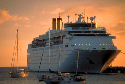
Protected marine zones to hit cruise industry
Cruise line operators will face additional protected marine areas with the launch of global mapping project by the International Council of Cruise Lines (ICCL) and Conservation International (CI) to improve biodiversity.
This joint venture initiative will enforce marine areas such as coral reefs, seamounts and shellfish growing areas that are currently absent in cruise line navigational charts.
New practices include adhering to no-discharge zones and a policy of no discharge within four miles of shore unless the ship is using an advanced wastewater purification system (AWPS).
The mapping initiative was one of 11 recommendations made by an independent science panel comprised of marine experts and chaired by world renowned marine biologist Dr Sylvia Earle.
The recommendations explored a variety of issues including wastewater discharge, installation of AWPS, disposal of sewage bio-residues, and increasing passenger awareness on waste management practices.
ICCL president Michael Crye said the ICCL would implement a majority of the panel’s recommendations immediately.
Chair of the science panel and executive director of CI’s Global Marine Division, Dr Earle commended the cruise industry’s support for the project.
“The science panel understands individual cruise ships and transportation routes will impact how each recommendation can be carried out. Implementation of this mapping exercise will be an important first step as the industry begins the process of reviewing and integrating the science panel’s recommendations into their operations,” Dr Earle said.
Executive director of Conservation International’s Center for Environmental Leadership in Business, Glenn Prickett said the global mapping initiative was an example of how the conservation community could work cooperatively with the cruise industry to achieve conservation aims.
Fish collection moves into the digital age
SAN DIEGO, March 20 (UPI) -- University of California-San Diego scientists say the same technology used to image brain tumors is taking the field of marine biology to new dimensions.
Researchers from the university's Keck Center for Functional Magnetic Resonance Imaging and the Scripps Institution of Oceanography have been awarded a National Science Foundation grant to create a high-resolution, three-dimensional MRI online catalog of fishes from Scripps's Marine Vertebrate Collection.
"This project will ... (use) a new tool and a new way to present information about fishes," said Philip Hastings, professor and curator of the Scripps collection. "It's part of our general effort to make the collection more available to a wider audience."
The five-year, nearly $2.5 million project supports development and application of new MRI technology that penetrates soft body tissue to provide 3-D images of physiological structures.
The Scripps' collection is among the largest and most comprehensive collections of its kind in the world, containing 90 percent of all known families of fishes.THIS ROCKS!!! With a good 3-D online database from a place like SCRIPPS, identification will become much easier... Let's face it the Peterson's Guides are hardly good for anything and Fishbase hardly has shit on any species except the most popular ones. This would be great for the scientific community, good 3-D imaging instead of shitty guides that say snout goes 2-3 times into head or fish with small scale-less pit on top of snout... I cannot wait!
Thursday, March 16, 2006
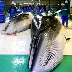
Tuvalu joins Palau, Nauru, Kiribati as Japan's 'bribes for votes' pro-whaling puppet
TUVALU (12 Mar 2006) -- Japan has pledged hundreds of thousands of dollars to the tiny Pacific nation of Tuvalu as it struggles under the weight of imported fuel costs - and denied that the funds were a bribe to win support for its whaling.
Tokyo inked similar deals last year for two other small nations in the Pacific, Nauru and Kiribati.
All three nations are members of the International Whaling Commission and support Japan's drive to reverse the IWC's 20-year moratorium on commercial whale hunting. They "absolutely" support Japan, said Geoffrey Palmer, New Zealand's commissioner to the IWC. "All recently joined the IWC and all are Japan supporters."
But Yujiro Akatsuka, an official at the Japanese Foreign Ministry's Economic Cooperation Bureau, denied the grants were linked to the nations' backing for Japan's whaling push.
"We want to support continued economic development in these countries," Akatsuka said Friday in Tokyo. "These kind of projects have no relation to their support in the IWC."
Tokyo has repeatedly failed to muster the three-fourths majority in the 66-member IWC needed to overturn the commercial whaling ban which took effect in 1986.
It has denied accusations of "vote- buying" among small, developing nations in the Caribbean and Africa as well as the Pacific in efforts to gain enough international support for its policies.
In July last year, former officials from Dominica, Grenada and the Solomon Islands claimed that Japan bribed their governments with aid to win support for its bid to overturn the international ban on commercial whaling. Japan denied the charge.
Tuvalu Prime Minister Maatia Toafa on Friday signed an agreement at the Japanese embassy in Fiji's capital, Suva, for 100 million yen (HK$6.6 million) of funds to meet 37 percent of the nation's fuel costs this year.
Most modern, educated Japanese do not eat whale and reject government propaganda that whaling is synonymous with being Japanese. But a small and politically powerful coalition of ultranationalist politicians, 'yakuza' crime bosses, fishing industry leaders and government controlled media including NHK promote the full-scale slaughter of whales in terms reminiscent of Japan's World War II rhetoric.
Thanking Japan's ambassador, Masashi Namekawa, Toafa said he was pleased with the speed with which Japan responded to requests for help, made in September last year.
"Japan can count on Tuvalu's support at various international forums on matters of common interest," he said.
Toafa said the grant will keep Tuvalu's power station running, allowing the Pacific island state to buy enough fuel to maintain two small transport ships and two fishing boats at sea. He said fuel import costs were the equivalent of 20 percent of total imports.
Tuvalu's 9,500 people live on nine coral atolls with a total area of 27 square kilometers, running their country on an annual budget of about US$5 million (HK$39 million).
This is absolutely incredible. And the main problem is that no nations have the backbone to stand up for things like this. We should be encouraging other nations not to join Japan in the crusade for commercial whaling, not sitting idle, just letting Japan agarner more support to rape the oceans. This is BULLSHIT... My next automobile will NOT BE JAPANESE!
Wednesday, March 15, 2006
Delegation to lobby for fishing days
NEW BEDFORD — Determined to ease proposed federal fishing regulations that would go into effect May 1, state and local government officials and fishing representatives are headed to Washington, D.C., today to meet with the top administrator of the National Oceanic and Atmospheric Administration.
Lt. Gov. Kerry Healey organized the meeting with Vice Adm. Conrad C. Lautenbacher Jr. to discuss potential alternatives to the proposed regulations, which would cut fishing days by nearly 50 percent to reduce overfishing on depleted stocks of cod and flounder.
Lt. Gov. Healey — who is running for governor — is "very concerned" about the impact the rules would have on the Massachusetts fishing industry, said her spokeswoman Laura Nicoll.
New Bedford Mayor Scott W. Lang and Dr. Brian Rothschild of the UMass Dartmouth School for Marine Science and Technology will join Lt. Gov. Healey at today's meeting, which is scheduled for 10:45 a.m. at the U.S. Department of Commerce. The meeting will also be attended by state Sen. Bruce E. Tarr, R- Gloucester, state Division of Marine Fisheries director Paul J. Diodati and Gloucester fisherman Vito Giacalone.
The proposed regulations would cut fishermen's already limited fishing days by 40 percent due to a new counting method that would calculate each actual day at sea as 1.4 days. In addition, fishermen would face an 8 percent reduction in their total days at sea, as required by federal fishing regulations, known as Amendment 13.
NOAA Fisheries Service designed the interim rules as a temporary way to reduce fishing pressure until a more permanent groundfish plan — approved by the New England Fishery Management Council in early February — is adopted sometime this summer.
Local fishermen have decried the interim rules, saying they would push some boat owners out of business. A few boat owners said they plan to keep their boats tied to the docks until the council's less stringent rules go into effect.
Oil Platforms should be kept as artificial reefs, scientist says
Oil Platforms Should Be Kept As Artificial Reefs, Scientist Says
By TIM MOLLOY
AP
SANTA BARBARA, Calif. (March 14) - Marine biologist Milton Love drives
a hybrid car, displays a banner of left-wing revolutionary Che Guevara
on his laboratory wall - and has backing from Big Oil.
The reason: his finding that oil platforms off California's central
coast are a haven for species of fish whose numbers have been
dramatically reduced by overfishing.
That is good news to oil executives, who are looking for reasons not to
pay hundreds of millions of dollars to remove the platforms once the
crude stops flowing.
Environmentalists say oil companies are simply trying to escape their
obligations.
"Just because fish are there doesn't mean the platform constitutes
habitat," says Linda Krop, an attorney for the Santa Barbara-based
Environmental Defense Center. "That's like taking a picture of birds on
a telephone wire and saying it's essential habitat."
The 27 platforms - skeletal-looking structures that house dormitories,
offices and massive pumps - were installed over the past four decades
and now produce 72,000 barrels of oil a day. Environmentalists and
coastal residents despise them for spoiling the view and disrupting the
ocean's ecology.
Federal law requires oil companies to remove the platforms when
operations are complete, though no one knows whether it will be years
or decades before the deposits under the sea floor run out.
Oil companies already are pressing state and federal officials to keep
the rigs in place, citing Love's finding that platforms provide homes
for bocaccio, cowcod and other fish.
The National Oceanic and Atmospheric Administration said last week it
might consider the idea but wants to know more about the effects of oil
platforms on marine life.
Since the 1950s, when heavy fishing began in the region, some species
of fish have been reduced to 6 percent of their previous numbers,
according to Love. Some fisheries have closed, and the fishing fleet
has shrunk by a third.
Love, a researcher at the University of California at Santa Barbara,
films fish from a submarine and then counts them in his lab. He says
some platforms are surrounded with fish packed as tightly as "cocktail
wieners in a can."
"If anyone wants to come up and count the fish, we'll provide the first
beer," Love says. "But they're going to have to bring the rest. And
they're going to need a few cases because we have 11 years of
research."
Love gets about 80 percent of his research money from the government
and the rest from the California Artificial Reef Enhancement Program, a
nonprofit group funded almost entirely by oil companies. It has
contributed about $100,000 a year to Love's research since 1999,
executive director George Steinbach says.
Love says no amount of oil money can sway his research - fish either
cluster at the platforms or they don't. And because they do, he says
his personal opinion is that the rigs should stay in place, cut below
the waterline so that ships can pass safely over them.
"If you remove a platform you'll kill many millions of animals," he
says.
Environmentalists say if the platforms were removed, fish would return
to the underwater boulder fields and rocky outcroppings that form
natural reefs along the Southern California coast.
In the Gulf of Mexico, more than 200 rigs have been converted into
artificial reefs, either by toppling them or by lopping them off.
Krop, the environmental lawyer, says rig-to-reef conversions make more
sense in the Gulf of Mexico because the waters there have a mud bottom
and fewer natural reefs.
Converting platforms between Long Beach and Point Conception north of
Santa Barbara could be $600 million to $1 billion cheaper than removing
them, Steinbach says. He says the oil companies would contribute up to
half their savings to state conservation programs.
Widespread opposition from environmentalists and residents has killed
legislation that would have allowed such a deal.
Now I cannot say without looking at actual data which side I would be on. However, I do know how artificial reefs are havens for fish, it serves as more structure than natural reefs and can support higher numbers of fish. I don't know what the rocky reefs are like in California, but if they are large numbers of fish, commercially important or otherwise, at these oil rig structures, then why not keep them, by removing the above water sections? I don't see how it is such a bad deal, especially knowing the economic benefits through both fisheries and tourism of having them...
Tuesday, March 14, 2006
FHSU Faculty Senate dissociates itself from Kansas BOE science standards
AT LEAST SOMEONE IN KANSAS HAS COMMON SENSE!!!:
In response to the Kansas Board of Education's 2005 Science Standards, Fort Hays State University's Faculty Senate recently passed its own statement of opposition and endorsed another.
At February's meeting, the FHSU Faculty Senate passed Resolution 05-02, stating that the senate does not support including intelligent design in state education science standards.
The Faculty Senate resolution reads:
In response to the recent decision to include Intelligent Design in the Kansas state science standards, the Faculty Senate of Fort Hays State University resolves:
It is the role and responsibility of the scientific community to assess the merit of the subject matter taught in the science classrooms of our public schools.
As such, the Faculty Senate of Fort Hays State University does not support the inclusion of material, such as Intelligent Design, which has so far failed to withstand scientific scrutiny based on rigorous and verifiable peer-reviewed research.
"We, as a Faculty Senate, feel it is important to have educational materials stand upon their own merits rather than be imposed by an outside agency," said Dr. Win Jordan, president of the Faculty Senate and assistant professor of accounting and information systems.
"We had asked our University Affairs Committee to develop a statement in response to the recent Intelligent Design controversy. The committee responded with our Resolution 05-02."
At the same meeting, the senate also endorsed a position statement by the Kansas Association of Teachers of Science, presented to them by Dr. Paul Adams, Anschutz professor of education and physics and a member of the KATS panel asked to distribute the KATS statement.
"As we reviewed the statement, we found it to be clear, well thought out, and compelling. We therefore agreed to endorse it," said Jordan.
The KATS position statement was released by the organization's Board of Directors. In a cover letter, board President David Pollock said, "The Kansas Association of Teachers of Science (KATS) is the largest science teacher association in the state of Kansas. The 18 elected board members represent elementary through college teachers. The following is the official position of KATS that was passed at the regularly scheduled board meeting January 21, 2006."
Pollock is a teacher at Hays High School, Hays USD 489.
The KATS response to the Kansas State Board of Education Science Standards 2005 reads:
Kansas Association of Teachers of Science response to the Kansas State Board of Education adoption of the 2005 Science Standards:
The Kansas Association of Teachers of Science (KATS) is committed to promoting quality science teaching and the scientific literacy of both students and citizens throughout the state of Kansas. Accordingly, the KATS Board of Directors rejects on both scientific and pedagogical grounds the 2005 State Science Standards approved by the Kansas Board of Education (KBOE). The 2005 Standards neither promote quality teaching nor the development of scientific literacy.
As the state-level affiliate of the National Science Teachers Association (NSTA), KATS is the largest organization in Kansas representing teachers of science. We offer our unhesitating support to teachers who continue to emphasize science teaching that parallels contemporary scientific understanding as it is practiced throughout the world as a search for natural causes.
By redefining science in the Kansas Science Education Standards, the KBOE is promoting intelligent design tenets that purport supernatural explanations as valid scientific theories. Given that the goal of the intelligent design movement includes replacing scientific explanations with theistic understanding and to see this design theory inappropriately imposed on our religious, cultural, moral, and political life; the KATS Board of Directors adamantly opposes turning Kansas science classrooms into theatres of political and religious turmoil blurring the Constitutional ideals of separation of Church and State.
Therefore, KATS resolves that:
--Kansas teachers of science should continue to teach science as it is practiced throughout the world, and not attribute natural phenomena to supernatural causation;
--Kansas teachers of science should explore with their students the extensive evidence for evolutionary theory and actively refute the so-called evidence against evolution, as outlined in the new science standards;
--The Kansas Association of Teachers of Science recognizes that the KBOE is exhibiting educational irresponsibility in ignoring mainstream scientific understandings by substituting its own religiously-motivated agenda;
--State assessments should not include items related to the disputed portions of the 2005 Standards, as these statements do not reflect the global view of the science community;
--The KBOE should reconsider the inclusion of non-scientific ideas about the origins and development of life in order not to damage the prospects for student admission to high-quality colleges and universities;
--The KBOE should be aware that their anti-science actions are in direct conflict with the recent Kansas Bioscience Initiative;
Be it further resolved, that the Board of Directors of the Kansas Association of Teachers of Science (KATS) does not support and disassociates itself from these Kansas Science Education Standards (2005) as approved by the Kansas State Board of Education and recommends continued use of the 2001 Standards for curriculum development and assessment.
"As FHSU Faculty Senate President," said Jordan, "I found both the resolution and endorsement of the KATS statement to be appropriate, even necessary, to help maintain the quality of education in Kansas."